![]()
The Seljuk Han of Anatolia
NURHAK CEVIRME HAN
 |
DISTRICT
46 KAHRAMANMARAŞ
LOCATION
37.961608, 37.605299
The Nurhak Çevirme Han is located 11km from the Çevirme, within the borders of the district of Kullar. It is located on the Elbistan-Malatya caravan route. It is located 10km from the Kamereddin Han.
Kahramanmaraş was an important town of the Anatolian Seljuks, due to its geographical position and location at a very strategic point of Anatolia. Researchers believe that there were many architectural works built by the Seljuks here, but all have been destroyed. However, there are several hans which remain, including this one.
DATE
1225-1250
The han is believed to have been built at the same time as the other Seljuk hans in this area, including the Sevdilli, Kuru, Coğul, Kurttepe, Nurhak, Kamereddin and Hanobaşi hans.
BUILDING TYPE
Covered (C) section only.
DESCRIPTION
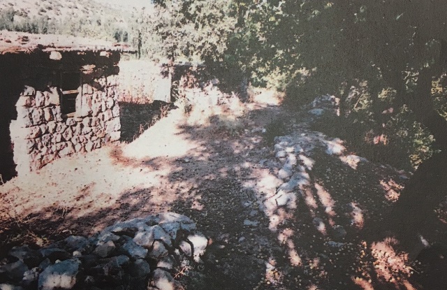
The han is oriented east-west. The han is built using rough-cut stones and rubble. The thickness of the walls is 1.30m. It is believed that the covered section had three naves and had 3 service rooms at the entrance, much like the Kurtepe Han, and was covered by barrel vaults. There are traces of three buttresses on the exterior walls.
STATE OF CONSERVATION, CURRENT USE
After this road fell out of use, the han was left deserted and fell into ruins. Only parts of the foundations walls can be seen and they are covered over with trees and brush.
BIBLIOGRAPHIC REFERENCES
Özkarcı, Mehmet. “Kahramanmaraş’ta Selçuklu Mimarisine Bakiş,” Uluslararasi Selçuklu Döneminde Maraş Sempozunu, 17-19 November, 2016, pp. 14-53.
©2001-2026, Katharine Branning; All Rights Reserved.